Flood Risk Mapping with GIS: How It Works and What It Costs
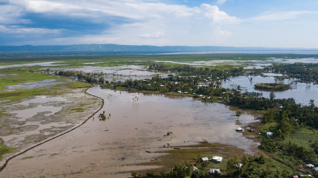
Flood risk mapping with geographic information systems (GIS) combines elevation data, hydrology, rainfall records, and infrastructure layers to model where water travels and who it reaches. GIS turns abstract flood zones into interactive maps that planners, emergency managers, and property owners use to prioritize mitigation, set insurance requirements, and act before water rises.
Key Takeaways
- Flood risk mapping uses elevation, hydrology, soil, and rainfall data layers to model how and where floodwater spreads across a landscape.
- Floods are the most common and costly natural disaster in the United States, and FEMA notes that one inch of water in a building can cause roughly $25,000 in damage.
- ArcGIS Online, ArcGIS Pro, and the Spatial Analyst extension carry most of the modeling workload, from terrain analysis to inundation modeling.
- Interactive dashboards and StoryMaps make flood findings usable for non-technical decision-makers and the public.
- Market rates for project-based spatial analysis work typically range from a few thousand dollars for a focused study to mid five figures for an enterprise model.
What is flood risk mapping with GIS?
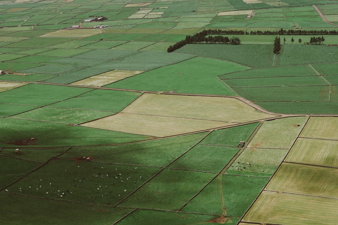
Flood risk mapping is the practice of identifying the areas most likely to flood, the depth water may reach, and the assets exposed when it does. In a geographic information system, every input becomes a spatial layer: a digital elevation model showing terrain, stream networks, soil permeability, land cover, and the buildings or roads at stake.
The result is more than a colored boundary on a paper map. A GIS flood model answers operational questions. Which homes sit below the 100-year flood elevation? Which evacuation routes go underwater first? Where will a culvert upgrade move the most people out of harm’s way? Because each answer is tied to a real location, teams can rank actions by impact rather than by guesswork. This kind of layered, location-aware reasoning is the core of spatial data analysis.
Why do static flood maps fall short?
Printed flood maps and older flood insurance rate maps still anchor many regulatory decisions, and they remain useful as a baseline. The limitation is that they freeze a single moment. Development changes runoff. Rainfall patterns shift. A subdivision built upstream sends more water downstream than the original map ever accounted for.
A GIS-based approach keeps the model alive. When new survey data or updated rainfall figures arrive, you rerun the analysis and the map reflects current conditions. Field crews using ArcGIS Field Maps can log high-water marks and drainage problems on a phone, and those observations flow straight back into the geodatabase that feeds the model. The map becomes a living record rather than a document that ages out.
What data goes into a GIS flood model?
Good flood mapping starts with good inputs. The most common layers include the following.
| Data layer | What it tells the model | Typical source |
|---|---|---|
| Digital elevation model (DEM) | Terrain shape, slope, and the paths water follows downhill | USGS 3D Elevation Program, LiDAR surveys |
| Hydrography (streams, rivers) | Existing channels and where flow concentrates | USGS National Hydrography Dataset |
| Rainfall and precipitation frequency | Storm intensity for 10-, 100-, and 500-year events | NOAA Atlas 14 |
| Soils and land cover | How much water infiltrates versus runs off | USDA SSURGO, NLCD |
| Building footprints and parcels | The people and property exposed to each scenario | County assessor data, local GIS |
Elevation data is the spine of the whole model. A digital elevation model, which is a raster grid where each cell holds a ground height, lets the software trace flow direction and accumulation across the surface. The finer the elevation data, the more credible the inundation output. LiDAR-derived terrain at one-meter resolution produces far more reliable results than coarse national data, which is why high-resolution elevation is often worth the cost on a serious study.
How does the flood mapping workflow work in ArcGIS?
A typical project moves through a clear sequence. The platform of choice is usually ArcGIS Online for sharing and collaboration, paired with ArcGIS Pro and the Spatial Analyst extension for the heavy modeling.
- Assemble and clean the geodatabase. Pull every layer into one geodatabase, set consistent coordinate systems, and apply attribute domains so field values stay valid. Clean data here prevents errors that compound later.
- Condition the terrain. Fill spurious sinks in the elevation model and derive flow direction and flow accumulation so the software knows how water moves across the surface.
- Model inundation. Combine terrain, rainfall scenarios, and channel data to estimate water surface elevation, then subtract terrain to produce flood depth grids for each storm scenario.
- Overlay exposure. Intersect the flood depth layers with building footprints, parcels, roads, and critical facilities to quantify what each scenario affects.
- Publish for decisions. Push the results to web maps, interactive dashboards, and StoryMaps so emergency managers and elected officials can explore the findings without opening desktop software.
The final step matters more than people expect. A technically perfect model that lives only on an analyst’s hard drive changes nothing. Esri out-of-the-box tools such as ArcGIS Dashboards and Experience Builder let you put live flood information in front of the people who act on it, with no custom code required.
Which industries rely on GIS flood risk maps?
Flood mapping serves anyone who manages land, infrastructure, or risk near water. Local governments use it to guide zoning, capital projects, and stormwater investment, work that overlaps heavily with broader GIS for local government programs. Water and stormwater utilities use it to size systems and plan resilience upgrades. Insurers and lenders use spatial flood data to price risk and meet disclosure rules, a pattern explored in GIS for insurance.
Environmental and conservation teams use the same models to protect wetlands, plan floodplain restoration, and balance development against natural water storage. The shared thread is that water does not respect property lines, so every credible flood decision starts from a spatial view of the whole watershed. Teams managing those systems often pair flood mapping with wider water resources GIS work.
What are the common pitfalls in GIS flood mapping?
Even capable teams make a handful of recurring mistakes, and knowing them protects the quality of the result. The first is relying on coarse elevation data for parcel-level decisions. National terrain data is fine for a regional screening, but recommending which specific homes need flood protection demands LiDAR-grade elevation. Mixing those scales quietly undermines credibility.
The second pitfall is treating the model as static. A flood study that is never revisited drifts out of date as upstream development changes runoff and as rainfall norms shift. Building the model in a geodatabase with clean attribute domains, so it can be rerun as new data arrives, is what keeps it useful for years rather than months.
The third is stopping at the technical output. A depth grid that no decision-maker can read does not protect anyone. The strongest flood programs pair rigorous modeling with clear communication, often through a StoryMap that walks officials and residents through the risk in plain language and shows what mitigation would change. The analysis and the explanation are two halves of one job.
What does GIS flood risk mapping cost?
Cost depends on scope, data quality, and how much of the work is modeling versus communication. As general market context, focused spatial studies often run in the low-to-mid four figures, while enterprise-grade flood models that cover large areas, multiple storm scenarios, and detailed exposure analysis commonly reach the mid five figures. The biggest cost drivers are the resolution of the elevation data and the number of scenarios you want modeled.
A practical way to start small is a productized engagement. GeoLever’s StoryMap-in-a-Week starts at $3,500 and can turn an existing flood analysis into a clear, shareable narrative for stakeholders. For full modeling work, scope is set and quoted within 48 hours of a 30-minute discovery call, so you see the number before any commitment. If you are weighing the investment, our framework on the ROI of GIS walks through how to value avoided damage and faster decisions.
Done well, flood risk mapping pays for itself the first time it moves a family, a road, or a treatment plant out of the path of a storm. The spatial model is the tool. The decisions it enables are the value. To explore a flood mapping engagement, see our spatial analysis services or start a conversation.
Frequently Asked Questions
What is the difference between a flood map and a flood model?
A flood map shows the extent of flood-prone areas. A flood model is the underlying analysis that produces those extents from elevation, rainfall, and hydrology data. The model can generate many maps for different storm scenarios, while a single map captures one outcome at one point in time.
How accurate is GIS flood risk mapping?
Accuracy depends almost entirely on input data. High-resolution LiDAR elevation, current rainfall frequency data, and verified channel geometry produce credible results. Coarse national elevation data gives a useful screening view but should not drive parcel-level decisions on its own.
Which ArcGIS tools are used for flood mapping?
ArcGIS Pro with the Spatial Analyst extension handles terrain conditioning and inundation modeling. ArcGIS Online, ArcGIS Dashboards, and Experience Builder share the results. ArcGIS Field Maps and Survey123 capture field observations such as high-water marks that feed the model.
Can flood maps account for climate change and future rainfall?
Yes. Because the model is data-driven, you can run it with updated precipitation frequency estimates or future-condition rainfall scenarios. This produces forward-looking maps that show how risk shifts as storm intensity changes, which is increasingly important for long-range capital planning.
How long does a flood mapping project take?
A focused study for a single watershed or jurisdiction can take a few weeks once data is gathered. Larger enterprise models with multiple scenarios and detailed exposure analysis run longer. Data acquisition, especially commissioning new LiDAR, is often the slowest step.